
In a Bush League of Our Own
Bush Hill Farm, Glastonbury & Manchester
January 2017 & November 2025
This is a Manchester Land Conservation Trust property.
The first half of this page features the eastern half of the property. In 2021, the property doubled in size with the acquisition of the former Lombardo Farm property, which expanded the land west. I hiked these newer trails in late 2025.
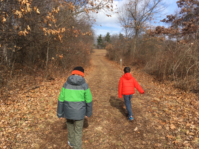
As I scan through my (way too many) pictures from our day out at Bush Hill Farm, I’m most inspired by Calvin’s red coat. It makes many of my hastily taken iPhone photos just… just look better. I recommend you buy red coats for your children for this express purpose.
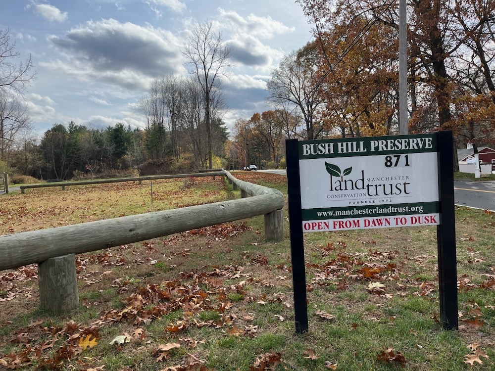
This property is one of the Manchester Land Conservation Trust’s newest acquisitions. It is 62 acres of former farmland in extreme southwest Manchester – in fact, it’s so southwest that it bleeds over into Glastonbury. Here’s a little history courtesy of the MLCT:
The Botti family farmed this acreage starting about 1912 – growing apples, peaches, cherries, and blueberries as well as vegetables – but the orchards are no longer productive. The Land Trust plans include restoration of the orchards and community farming in addition to the 2+ miles of hiking trails. Some of the old fruit trees still grow on the property, and there are quaint barns and a farm pond. Bush Hill itself is on this property – the highest point in the southwest section of Manchester.
Really? We’re noting highest points in Primary InterCardinal direction subsections of towns now? Wow, I thought I was crazy.
Well folks, my sons and I have climbed the highest point in southwestern Manchester, Connecticut. I can’t wait to tell them tonight.
Have you ever wondered what maintaining open space costs? Here’s a little peek into this world:
… at a purchase price of $915,000. The State of Connecticut DEEP granted $594,750 and the Town of Manchester granted $98,000, both through open-space-purchase programs. Stipulations of the State grant include razing the existing farmhouse which, with other expenses, may cost the Land Trust several hundred thousand dollars. The Conservation Fund, a non-profit environmental organization in Arlington, VA www.conservationfund.org has provided a $210,000 loan as “bridge financing,” and the Land Trust is undertaking a $500,000 fund-raising campaign.
As an avid land trust hiker, I want to say thank you to the tireless efforts made to make these places happen. Grant writing, surveying, lobbying, etc. Well done to the MLCT!
And the property itself is quirky, fun, and interesting.
No, really, it’s true.
Damian started this one off on the wrong foot and it took him a while to get going. We hiked the property counter-clockwise – saving the highest point in southwestern Manchester until the end. No-brainer.
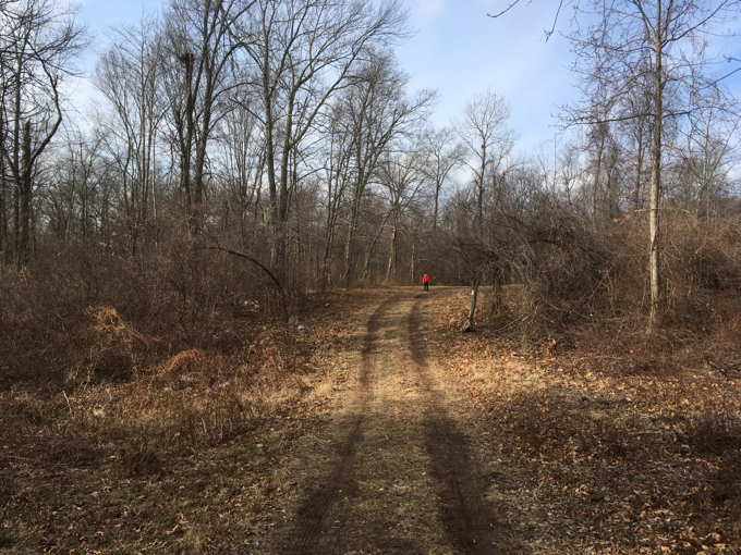
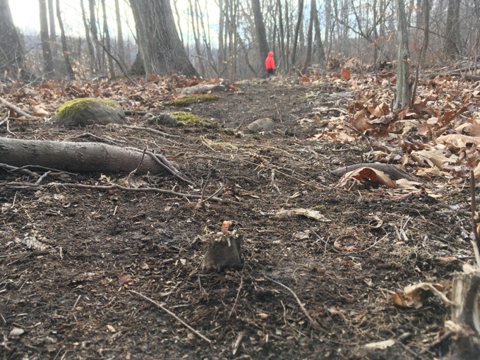
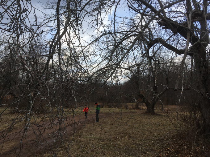
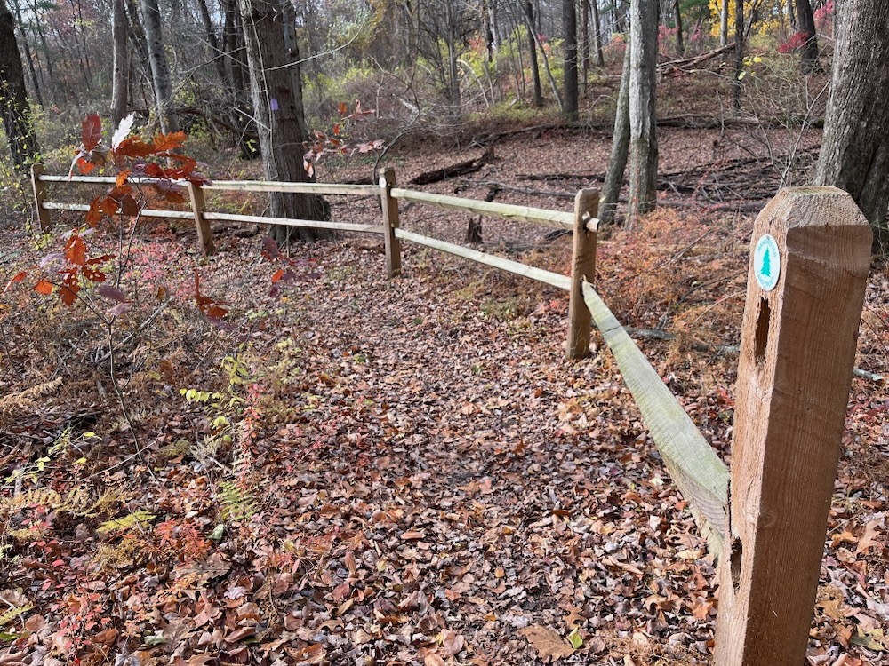
From the parking area, the trail seeks to find its own path and wonders across and off of old woods roads and powerline cuts. The trail here was brand new in late 2016, as it was evident that many saplings and even smaller trees were cut to clear the path.
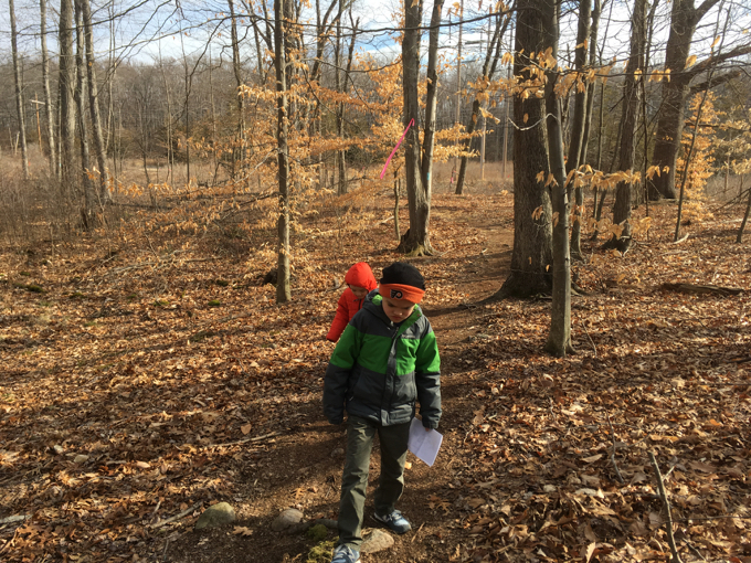
For whatever reason, Calvin was fascinated with the little tree stumps and felt the need to point each one out to me. It had something to do with his desire to be a Trail Ninja. And Trail Ninjas are hyper aware of anything that could bring misery upon a hiker. So by avoiding the endless pitfalls that can come with little mid-trail stumps, he was attaining his lofty title of Trail Ninja.
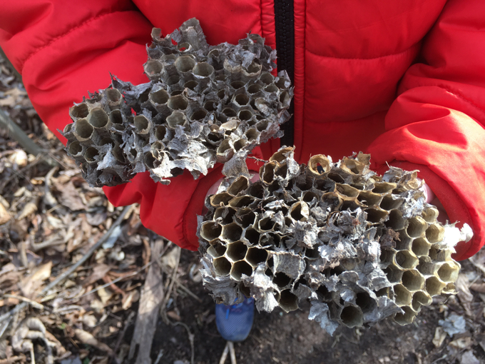
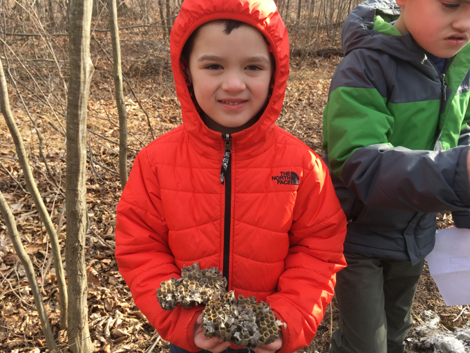
We also found the remnants of what must have been a rather large paper wasp nest. Calvin, as any 5-year-old should, wanted to bring it home to show Mama. She loved it.
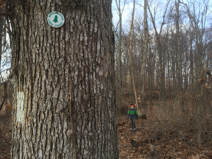
The trail wound its way towards some houses and then crossed a brand new bridge as it neared the Glastonbury border. How do I know this? Because the MLCT (I assume) cleared a short little spur trail up to an old border stone. Huge props to the MCLT for doing this, as literally everyone who ever makes their way to the extreme southern reaches of Bush Hill Farm will surely appreciate this little detail. Calvin did:
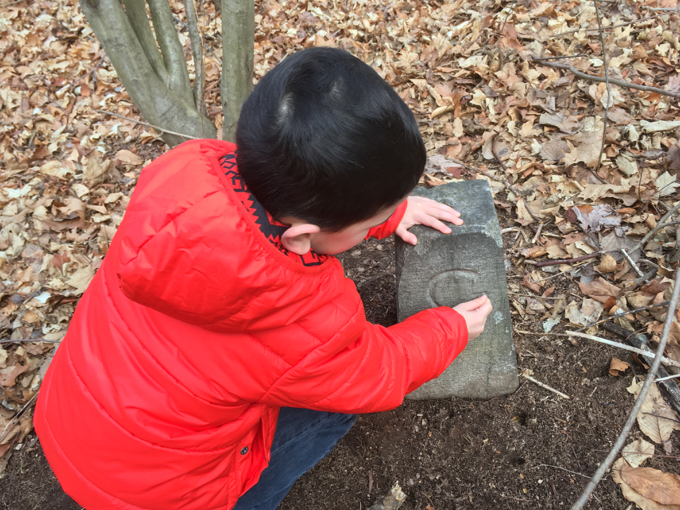
That’s a G for Glastonbury
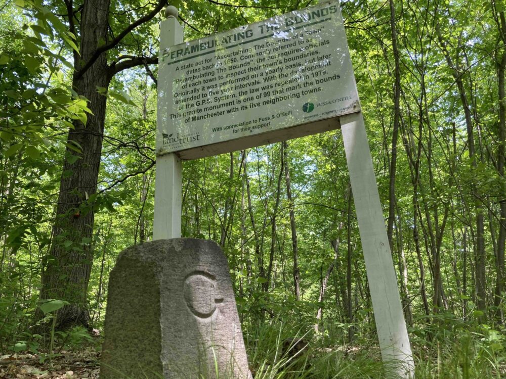
(Although, can I call attention to something the MCLT did that drives me bananas? Their map of this property is oriented to the south. Grrrrr.)
Update: the newer map in 2025 is properly oriented. And there’s also a perambulation sign in the woods at one of these border stones:
Picture from Explore Connecticut
We cut a corner and made our way up to a place that I’m not so sure we’re supposed to see quite yet. Surely the farm dump will be cleaned up over the course of 2017-18 or so, but for now, there are a bunch of rusted out shells of farm trucks and tractors and such.
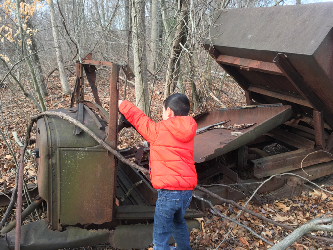
What’s a little tetanus among family?
I cut the corner in order to check out “Frog Corner.”
I have no clue what Frog Corner is. Or why it is. I can, however, confirm that it is. And here it is:
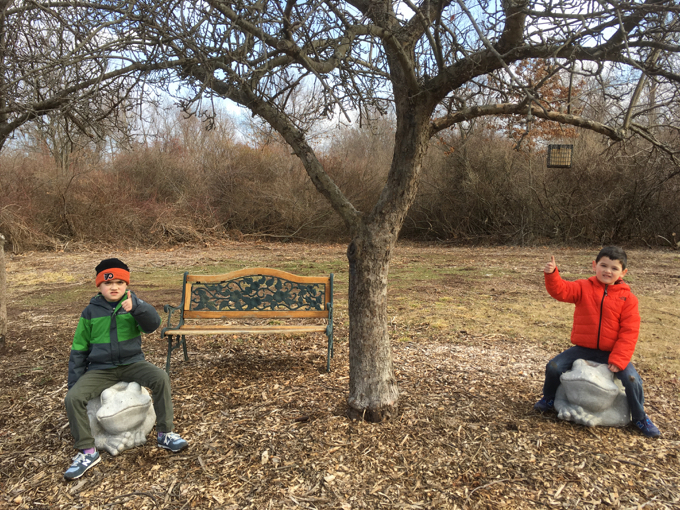
That’s right. There’s a bench. And two large stone frog statues that my children are sitting upon underneath a bird feeder on an abandoned farm in extreme southwestern Manchester.
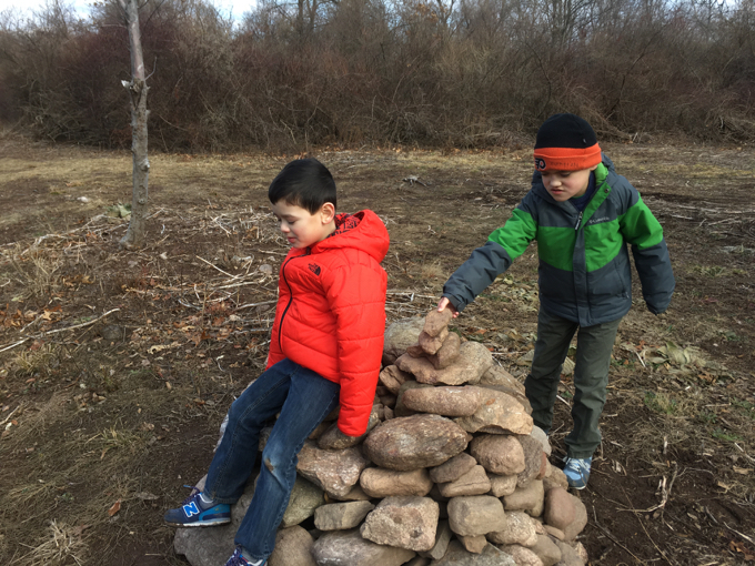
There’s also a cairn.
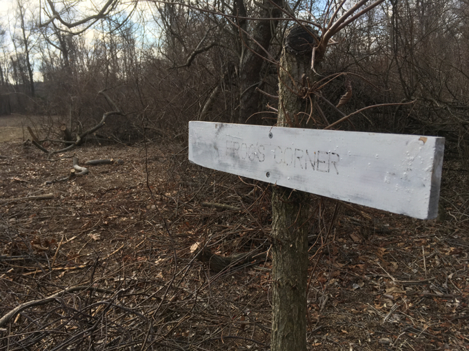
And a “Frog’s Corner” sign that has seen better days.
And it’s surrounded by farm junk and scraps and brush piles and old tires.
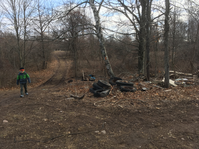
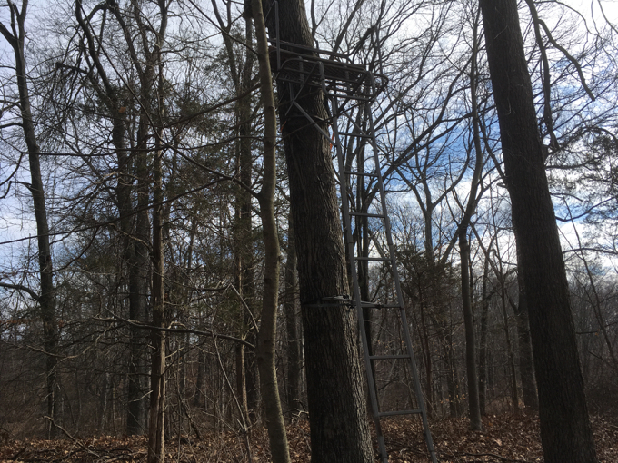
And a hunter’s stand.
We moved on along a farm road; down into a little swale. I saw a herd of deer over yonder and excitedly told the boys to “look over there! In that field! So many deer!”
Calvin, who hasn’t yet seen Stand By Me and its iconic deer scene decided to say hello.
Or rather, scream hello: “HELLOOOOO!! DEER!!! WHERE YA GOIN?!”
Sigh.
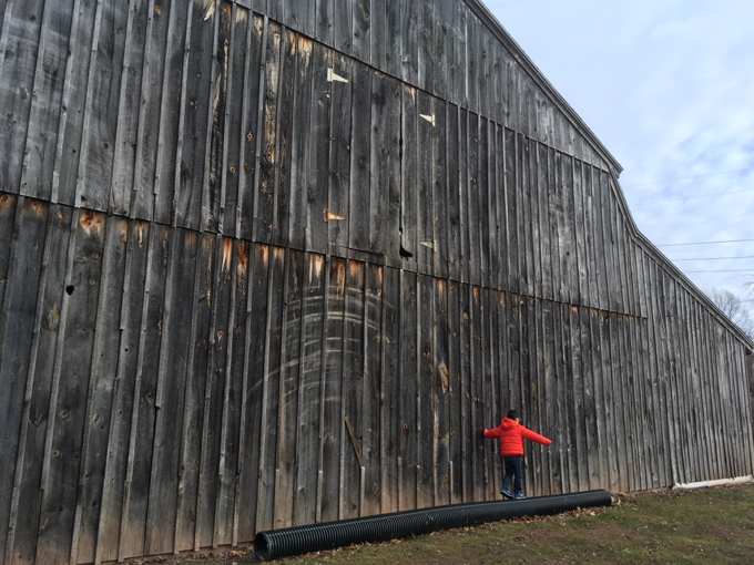
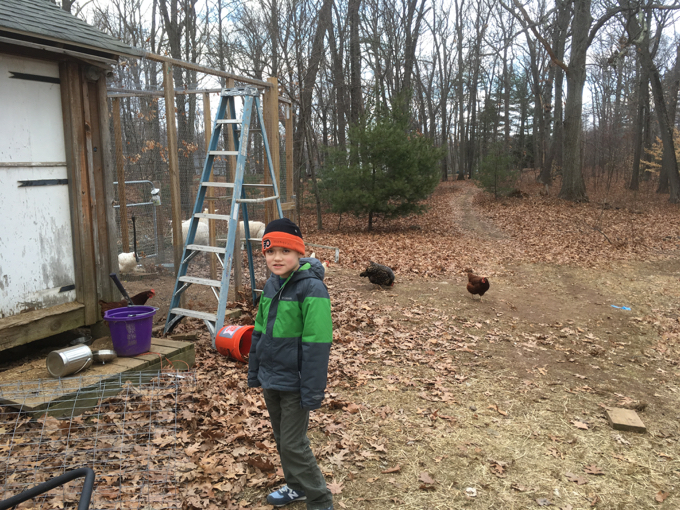
From there, we scampered up… what must be THE Bush Hill.
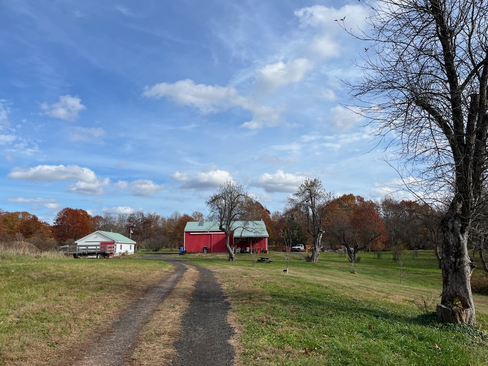
It’s… a hill. And there are some old farm buildings.
There are a few trails in this part of the property; some offer short cuts but they are so similar to the “outer” trail that I don’t really understand the point of them. They all meet up atop the hill and take hikers down an old road towards some houses where people still live.
Not just people… but also goats and chickens!
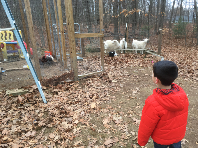
The boys loved the animals, but we were slightly off the trail and quite literally in someone’s backyard. I’m not a fan of that, so I hurried them along back to the trail.
The true trail, which I’m sure no one ever follows, turns away from the houses and back onto the old farm property as it approaches the hiker’s lot. People SHOULD follow this as continuing straight on the old farm road brings you fairly close to backyards.
Old orchard
Once my sons caught sight of the car, there was no way they were going to take a ten minute detour back into the old orchards and stuff. Sorry.
If I had the time and wherewithal, I think it would be really cool to rehike Bush Hill every year for the next 30 years. I’m sure it will undergo some pretty significant changes and that will be fun to see.
Just keep me updated and make sure no one takes the stone frogs.
![]()
November 2025
Be sure to read Bob’s comment at bottom regarding the work the Trust has been doing here in 2025 and beyond.
This western half of the property is a good example of how these land trusts work. Grants, stress, deadlines, more stress, and sometimes, like here, success! Acquiring this property was frustrating and came down to the wire.
The trust closed the deal on the Lombardo property for $1.7 million after more than two years of gathering grants and donations. The funding included $900,000 from the town, $300,000 from the state, $315,000 from an unnamed Manchester resident and donations from many other individuals and organizations. Getting grants and donations is work. And it’s often thankless – so thank you MCLT! (And the very generous private donor of course.)
As with many of these places, it was slated for ugly giant new houses with no yards in the mid-2000’s. Shout out to the Bush recession and market crash for ending that idea. But that development did get as far as clearing old farm structure and removing a waste pit here at the former pig farm.
Yes, the Lombardo Farm was apparently a pig farm. I can report that there’s no evidence of that in 2025. There are several very nice trails and old farm roads to explore, however.
I parked on Hillstown Road in the nice big lot. My plan was simple: hike these new trails east to where I was with my sons 8 years ago. You, of course, can venture further east to experience some of the above.
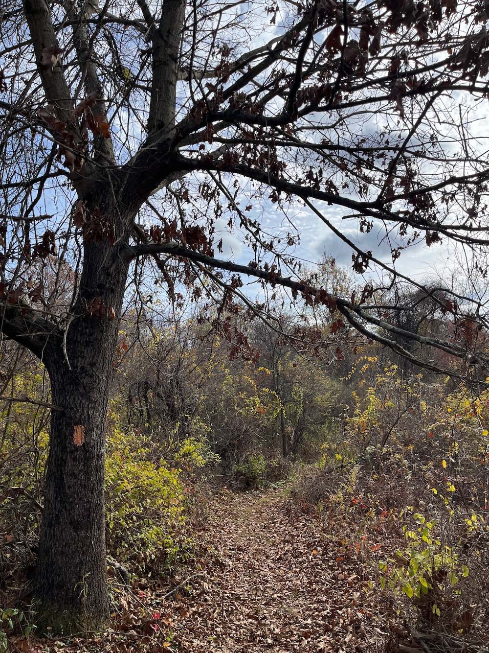
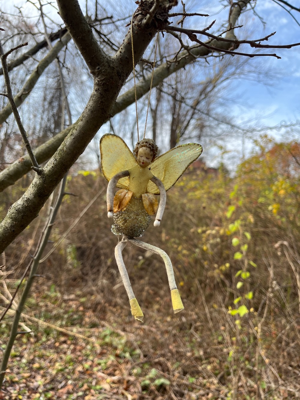
I would, however, encourage you to do the orange trail, which heads south from the main farm road shortly after beginning at the hiker lot. It rapidly ascends a little hill through a pine grove before crossing another dirt road and beginning a loop. Find this loop.
Someone, or more likely some people, have put a lot of effort into making is a very cute and fun little “Fairy Trail” or somesuch. All along the flat loop there are decorative little houses and items of whimsy. It’s kept to a fairly tasteful volume and is, I’m sure, super fun for little kids to discover.
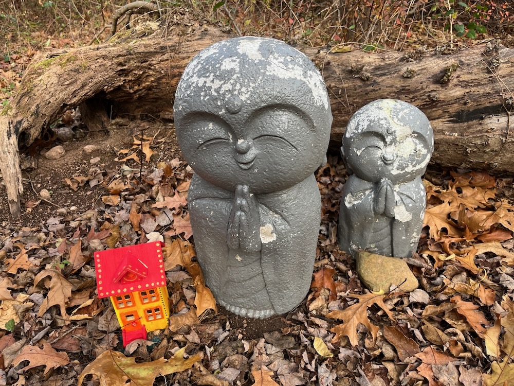
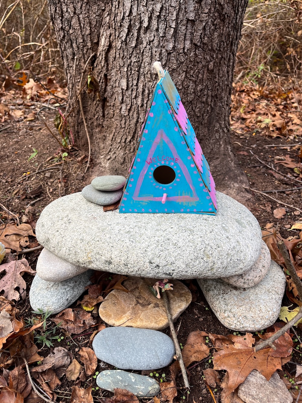
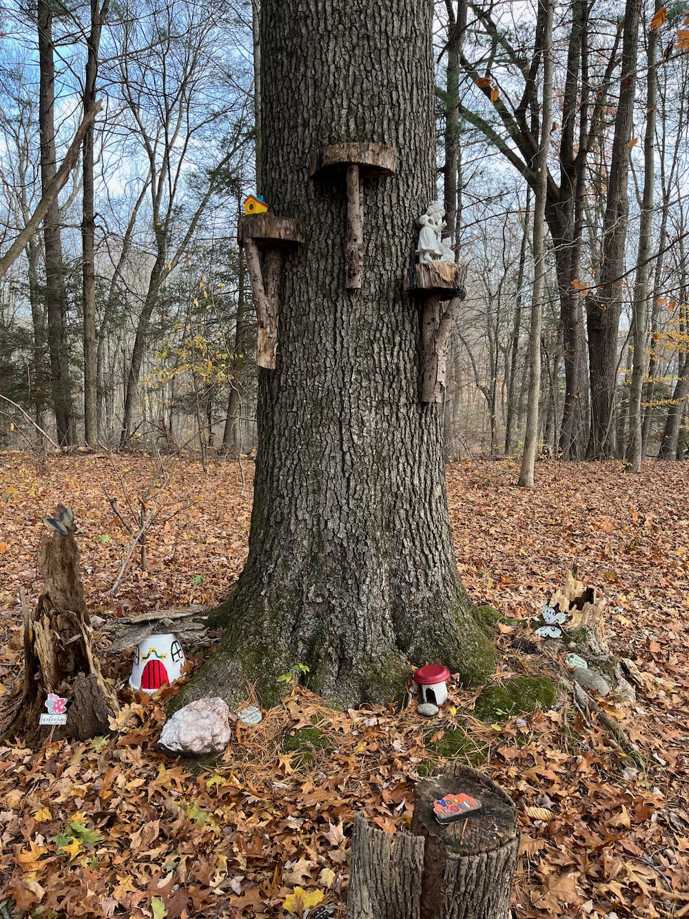
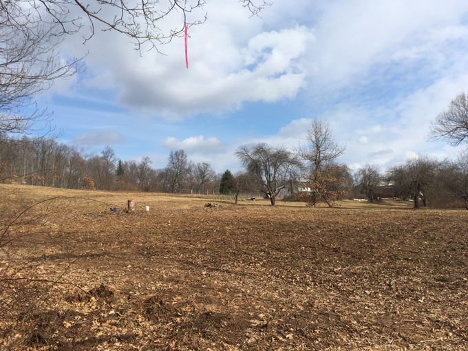
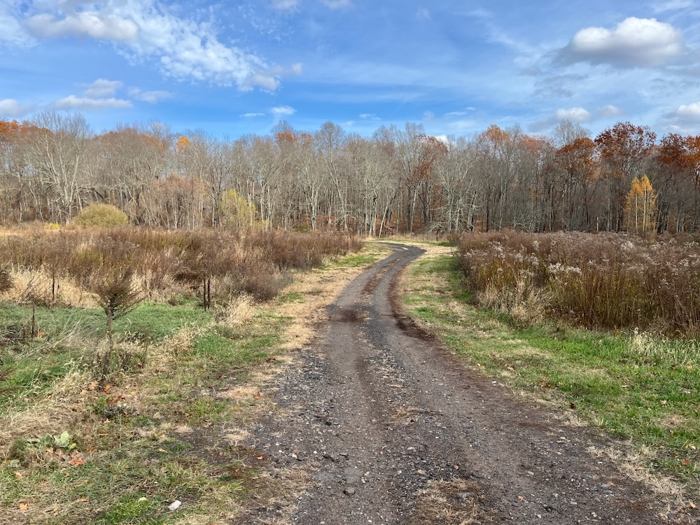
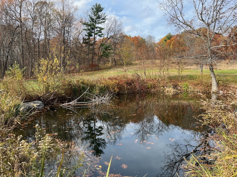
After completing the orange loop, I continued east on the farm road towards the center of the property and the barn that still stands there. There’s also a little pond and a nice little hill to climb to get a proper view of things.
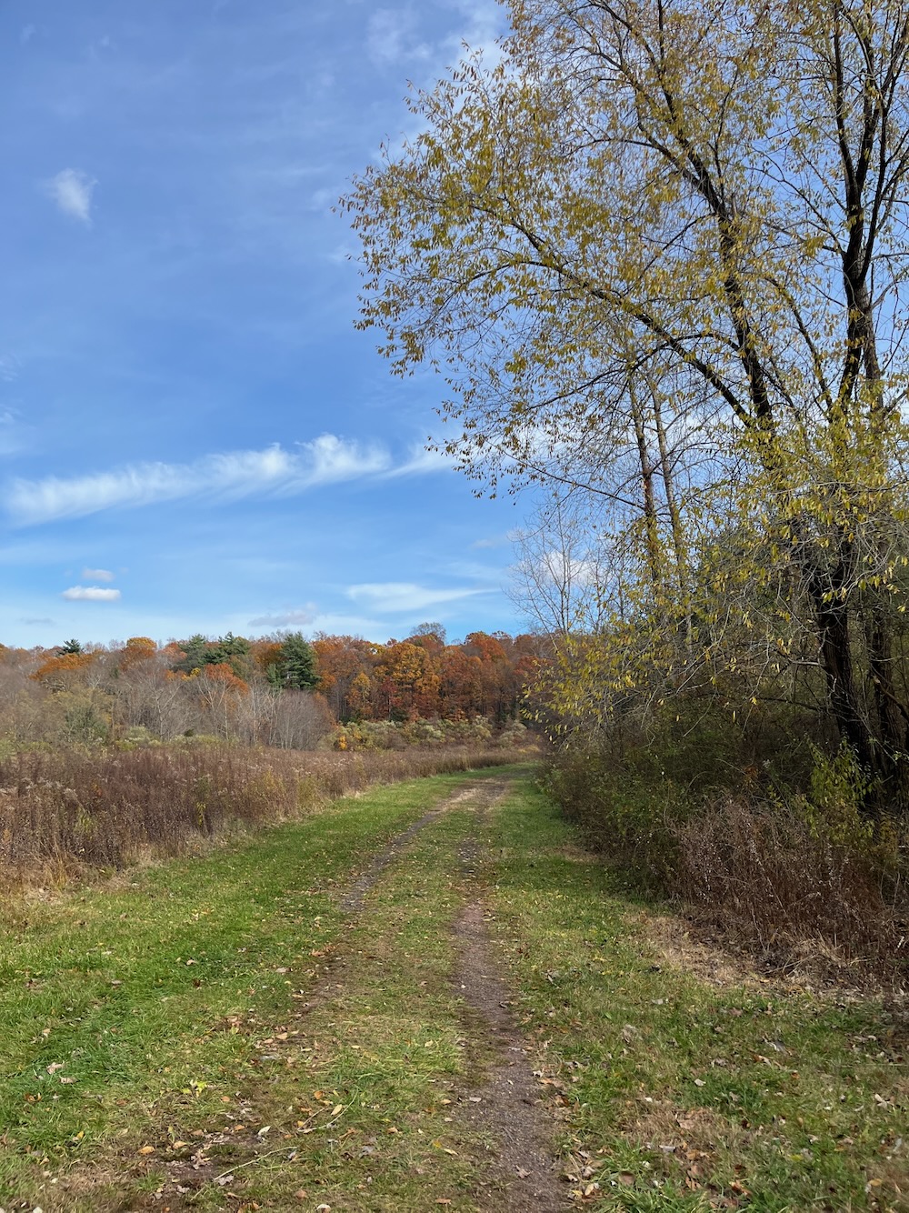
This is New England in miniature. An old farm, fading fall foliage, and white clouds wisping in a blue sky.
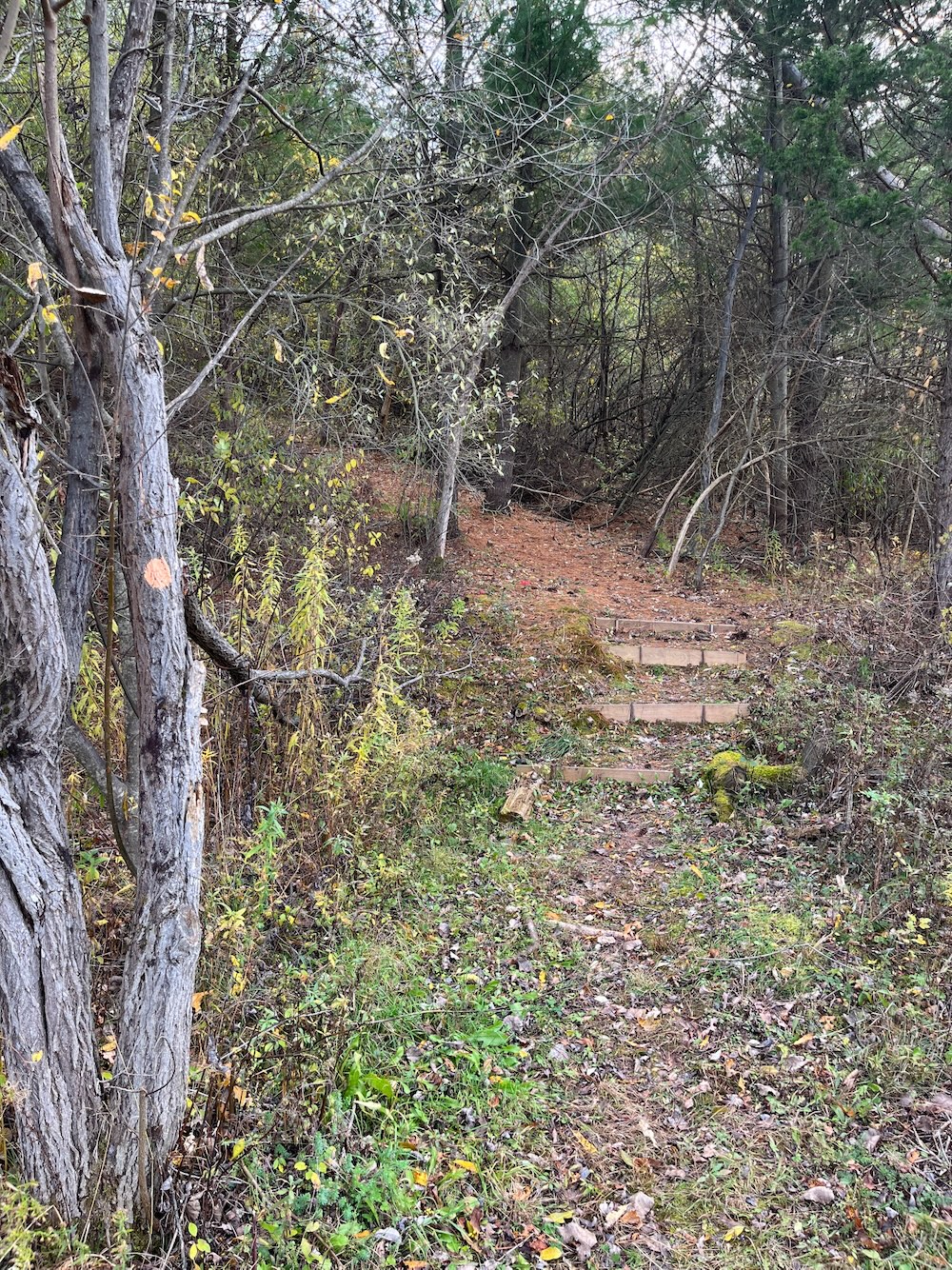
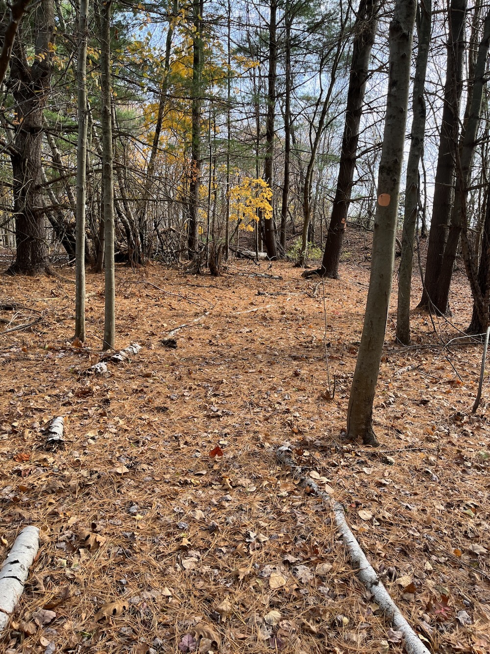
From there, I headed back into the woods, summitting Bush Hill before finding the white trail to begin my journey back west to my car.
New housing has encroached on this section, but I’d guess the effect is less in the summer with more vegetation and leaves on trees.
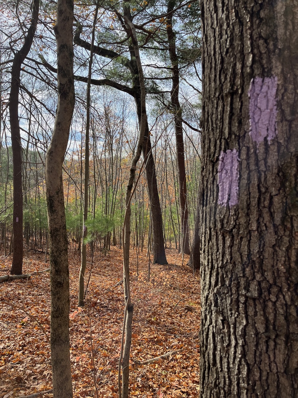
The white trail has some steeper sections coming off of Bush Hill, but levels off and intersects with a purple-blazed trail that took me to Gretz Pond.
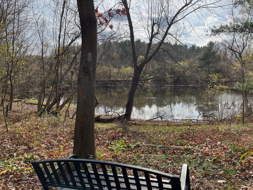
It’s an a’ight pond I guess. After that it was a quick jaunt across a field back to the dirt road I began with.
Manchester is full of little properties for escape. This one is a bit bigger and is really quite nice, especially considering its surrounded by suburbia and golf courses. Well done MCLT!
![]()
Bush Hill Farm brochure and map
Manchester Land Conservation Trust
CTMQ’s Manchester Land Conservation Trust Trails
 Twelve Mile Circle says
April 26, 2017 at 2:08 pmWhat’s weird about noting highest points in Primary InterCardinal direction subsections of towns? — sounds completely normal to me.
 Bob Melusky says
November 12, 2025 at 9:21 amThe high point was set up for a tower with a beacon for survey purposes. I think they would set them up on a temporary basis and then take them down when the project was over or perhaps move them to another location.
It is definitely not the highest point. I was in a Hollow just up the street in the elevation in my backyard is higher than the elevation of Bush Hill.
I did get a nice tour of all the work they have been doing. They’ve planted hundreds of trees and native shrubs with guidance from the Audubon Society and others. I arranged a handshake with a chestnut Society and they now have one of their genetic bank orchards planted between the neighbor’s goats and the service barn in the middle of the property. It’s a great edition to the land trust and hopefully it will make some contribution after my life time to re-populating the eastern forest with the once dominant chestnut tree.