
Just Stick to the S’nip
Shenipsit State ForestTrails, Ellington, Somers & Stafford
December 2016 & December 2023
Much has changed up here since my first visits, but I’ll try to retrofit this page to some degree. If you are looking for the Bald Mountain Preserve and Pinnacle Loop Trail in Somers, go here. The rest of this page describes the other blazed trails around the state forest. These include horse trails, old woods roads, and other trails. For the actual Shenipsit Trail through here, go here.
The difficulty hiking many of our state forests is that they are parceled and spread out all over the place. The Shenipsit State Forest contains 11 parcels spread over 7,000 acres in northeastern Connecticut. But that’s not your problem.
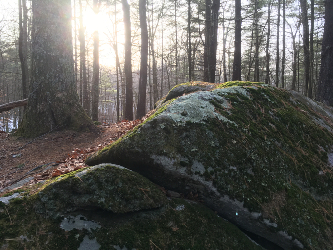
This is not fun hiking
If you decide to go exploring these woods up in northern Connecticut, your problem is going to be simply not getting lost.
The best (and probably only) resource for the trails here is the DEEP (Link at bottom). There are several different maps and several of the trails are “CT Horse Council” horse trails. I walked many of the horse trails as well as unmarked trails and old woods roads and, of course, actual footpath trails.
Stafford
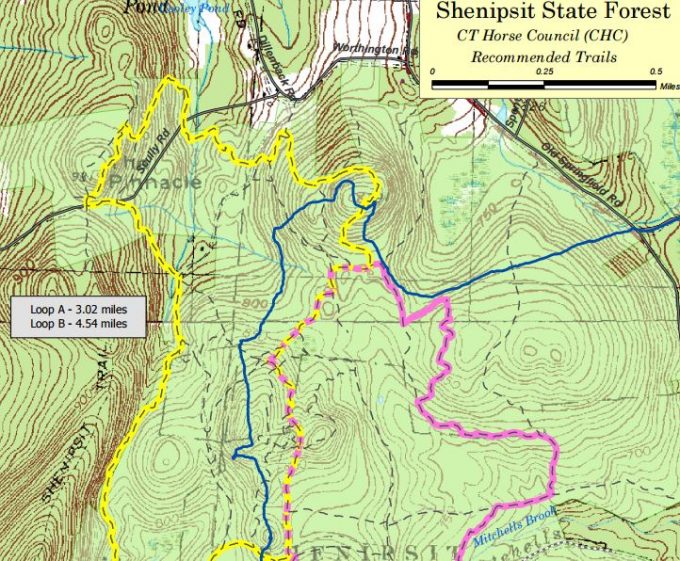
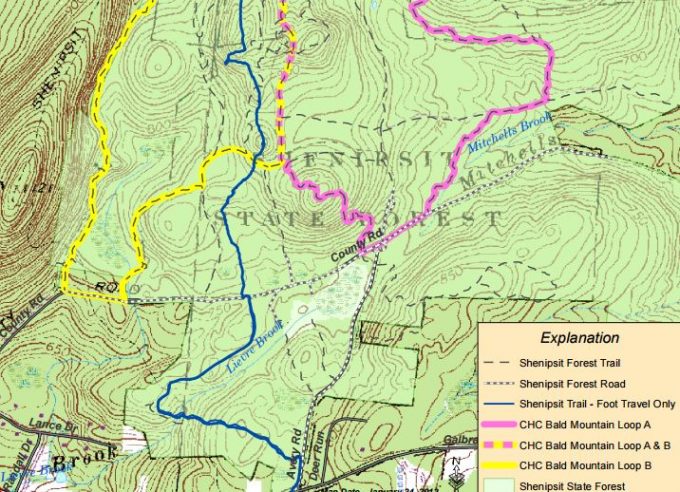
Looking at this map above, the blue trail is the CFPA’s Shenipsit Trail. If you look at the left hand side, you’ll see a trail labeled “Shenipsit Trail.” This is the old route of the S’nip, which went up and over Bald Mountain back in the day. (Bald Mountain is at the bottom left of the map.) I have no idea why the blue trail was moved eastward, but surely it had to do with property ownership. Since that trail was moved, Bald Mountain itself was purchased by Somers and the Northern Connecticut Land Trust has created the Bald Mountain Preserve with its own trails, often borrowing pieces of the old Shenipsit.
You see the yellow and pink trails, sure, but look closer. There are a bunch of other trails here – and this map doesn’t account for them all. Trust me. (My best guess is that the yellow and pink are actually the old woods roads I walked along – and they are pretty crappy to hike on but that’s fine since they are horse trails. Which I don’t think I realized back in 2016.)
When the Shenipsit crosses one of these other road/trails, the maintainer has made it VERY clear which way his blue trail goes.
When I sought to complete the Shenipsit’s new (at the time) northern extension, I parked on Greaves Road and made my way south via a variety of these State Forest trails.
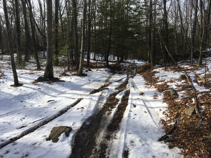
I consider myself an expert navigator, but even I got screwed up a couple times here. This map isn’t all that accurate and when you have roads that can be ATV’d, you end with with many more ATV/motorcycle trails all over the place. And that’s what has happened up here.
Furthermore, and more importantly, there’s really no reason for you to try to hike these trails. They’re garbage. Stick to the Shenipsit and every time you cross or pass near a rutted and torn up woods road say to yourself, “Ah, that’s some of that junk Steve was talking about.”
Let’s read a bit about this place before we tackle some more of it.
Shenipsit State Forest began in 1927 with the purchase of land at the summit of Soapstone Mountain in Somers to erect a fire tower to keep a lookout over the forests of the eastern woodlands. Over time, additional acreage was purchased to form the sprawling 7,078 acres state forest we have today in Ellington, Somers and Stafford.
Here’s my 2010 hike through the more southern Stafford section of the Shenipsit Trail.
Shenipsit is dominated by nearly pure stands of oak, particularly red oak, as a result of repeated clear-cutting for charcoal production and as a result of fire. All of this occurred prior to State ownership.
…There is an abundance of recreation opportunities at Shenipsit State Forest. The two primary attractions are the wonderful hiking along the Blue-Blazed Shenipsit Trail which passes over Soapstone Mountain and the amazing views from the Soapstone Mountain observation tower. While the original fire tower is long gone, today’s tower stands specifically for the public’s recreational viewing. As one of only two observation towers in Eastern Connecticut (the other being the monument at Fort Griswold State Park in Groton), the vistas afforded from this vantage point are spectacular as visitors can take in scenes from the Connecticut River Valley to the Springfield skyline.
The fire tower existed when I first visited it in 2010. Then it was “closed” but I still climbed it with my sons in 2015. Then it was closed for real. But it rose like a Phoenix and was rebuilt, so I climbed it again in 2023. The entire saga can be found here. (It’s also in Somers, not Stafford.)
I’m not sure what else to talk about here… Avery Road is drivable and allows for parking if you’re doing the Shenipsit section or really wanted to hike some horse trails. There’s a pond near Old Country Road and I was surprised to find a bunch of kids playing pond hockey on it.
Who were these kids? Where did they come from? How did they get here? (And props to them for not being at home on the couch Snap Chatting their friends.)
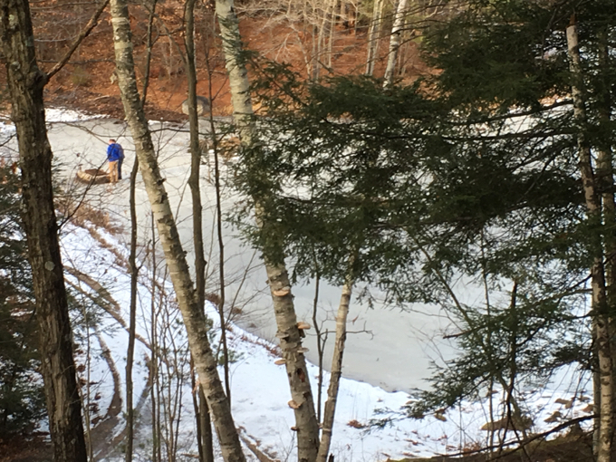
Kids on the pond
I passed an old man smoking pot while walking his dog. Keep it real, Stafford. We chatted about the kids on the pond and he was very nice, as was his dog. He referred to the little bump south of the pond off of Avery Road as “Heart Attack Ridge.” I found that to be a bit of an exaggeration.
South of route 190 are some more trails to the east of the Shenipsit.
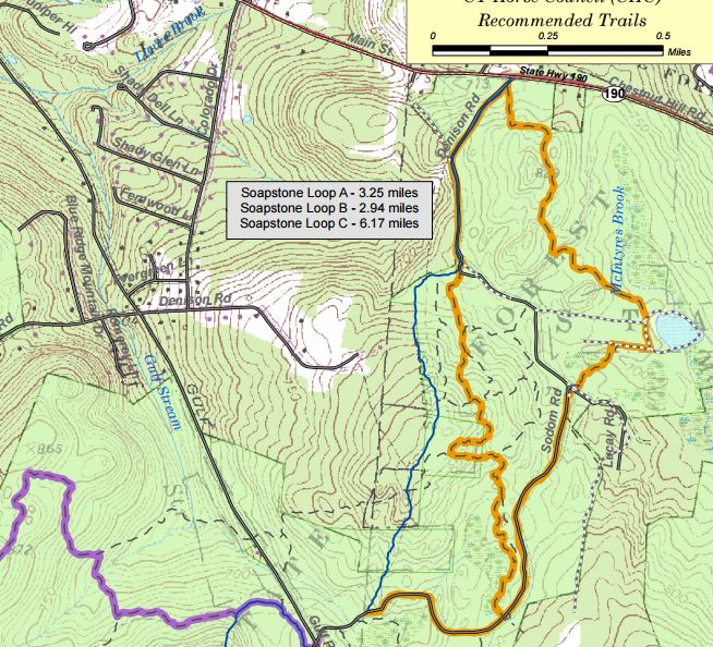
I parked in the little lot at the entrance and began to make my way around the orange loop on the map. After a few minutes of crunching my way through the ice and snow I said to myself, “Self, this is stupid. No one needs to know that this trail walks past trees and rocks.” This orange trail is also a horse trail.
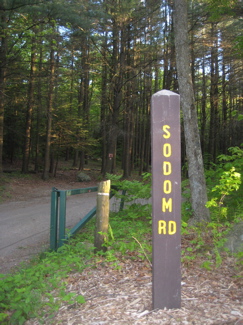
The only things worth noting here are Sodom Road and the Northeast Civilian Conservation Corps Museum a little ways east on 190. And I’d already hiked/visited both. So I went back to my car and called it a day. I’m sure you don’t mind. This also allowed me to say that the Shenipsit State Forest trails in Stafford were complete… because for all intents and purposes, they were.
Somers
There’s really not much to report here that is worth reading about. Of course, Soapstone Mountain’s summit is in Somers and therefore the tower is in Somers, and the trails around the summit are (mostly) in Somers and that’s all super cool. I’ve also written about all of that on the Shenipsit Trail and tower pages. So what, beyond that, lies in Somers within the state forest?
A trail. An okay trail that more or less takes a western route away from the Shenipsit. As ever, state forest trails can often be poorly marked and just plain confusing. The map available on the state’s website is from 2002, and not only is it outdated in terms of trail geography, the two “Somer/Somers” mistakes are kind of hilarious from the STate of Connecticut:
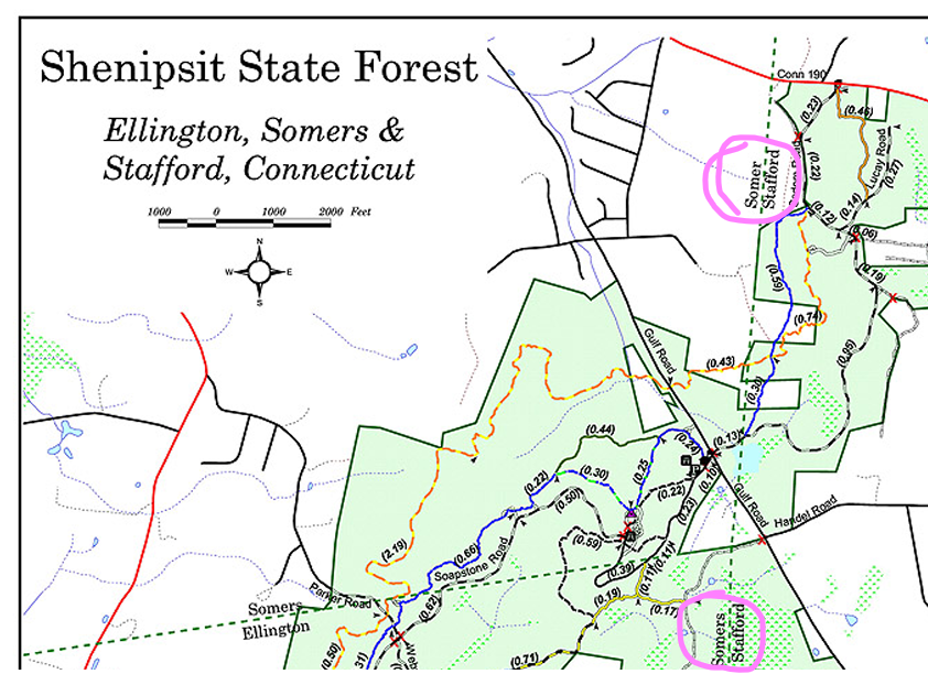
The Somers at bottom is… Ellington.
If you enter these woods armed only with that map, you’re kind of screwed. Or, if you’re the adventurous type, you’ll have more fun. Because hey, maps are cool and all, but you like to just wander aimlessly for miles and miles.
(Yes, I’m aware there are apps now like AllTrails, TrailLink, and Trailforks and probably some others that refuse to put spaces between words for some reason.)
The Town of Somers has a better map of their town’s area of the state forest:
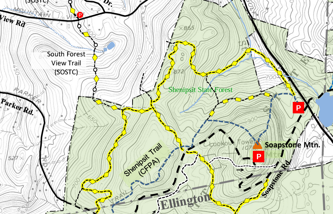
Ahhh, that’s better. On the day I decided to poke around this northwestern section of the forest, I approached via the South Forest View Trail. This is not a super awesome trail, but it connects this massive state forest trail network to the Northern Connecticut Land Trust’s Whitaker Woods and McCann Family Farm Trails systems. And that is super awesome.
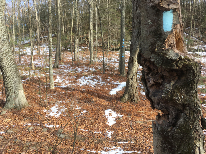
My plan was to walk a yellow-blazed loop just to get a feel for the woods here. I’m not sure what I was expecting, but once inside the state forest boundaries, I immediately found myself on some random trail marked by ribbons. Now, I know that I was on a yellow trail, and I know those ribbons are from a Soapstone Striders trail race, but I also know not to trust state forest trail blazing.
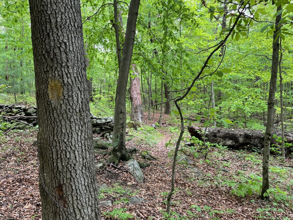
Faint yellow blazes
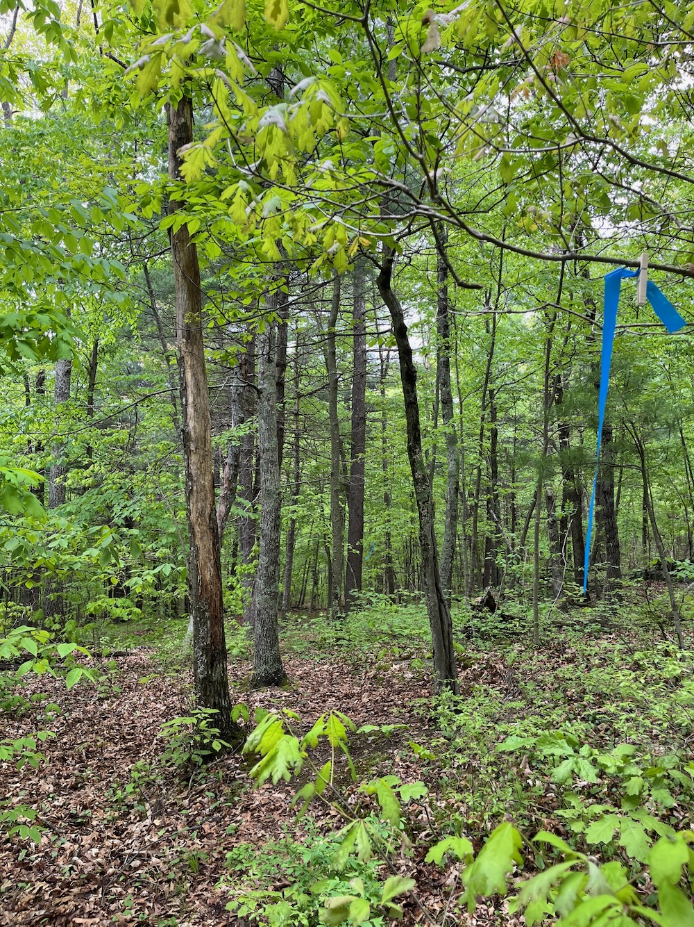
Blue ribbon “blazes
Because if often doesn’t exist. Which is fine. Outside of the tower area, it’s not like “come hike the far-flung western reaches of Shenipsit State Forest” is a thing. To anyone. Ever.
Regardless, the trails are cleared well and if you have a good sense of direction, you’ll figure it out. Go south and hit the blue-blazed Shenipsit. Go east and hit a road. You’ll be fine.
Go further south and continue poking around the forest’s trails in Ellington. Go further east and wind up doing the same in Stafford as described above.
Ellington
![]()
DEEP’s Shenipsit State Forest page
CTMQ’s Shenipsit State Forest page
CTMQ Hikes the Shenipsit Trail
CTMQ’s State Forests
Leave a Reply