
A Seriously Mixed Bag
12.2 Miles in Manchester, Bolton, & Vernon
March 2010
I’m glad I had a partner for this hike – the learned Dennis Paul Himes (trailname: Cumulus) – or else I may have gone crazy. For this is one very strange stretch of the Shenipsit.
Four towns, three town parks, two state parks, two Wildlife Management Areas, a couple road walks, rain, sun, raging brooks with deceptive depth, ten-foot-wide easements between new houses, surprising beauty, lakes, old rail beds, a Braille trail, pitch pines, two Interstate highways, reservoirs, a gas station… Yeah, this was a weird one. In a way, this hike through central Connecticut is probably more in line with people’s expectations of what hikes around here are like… But at the same time, Dennis and I kept reaching seemingly faraway places with resonant beauty and all the appearances of solitude, despite the fact we were never more than a couple miles from either I-384 or I-84.
I loved it. And I hated it. But, as you’ll read, it turns out that the things I hated about this section give me more reason to love our blue-blaze trail system here in Connecticut. Oh, why don’t I just shut up and get on with it.
In all honesty, this central stretch of the Shenipsit exists to connect five cool parks together via one trail. The miles between and after those parks can be a bit iffy at times and unless you’re a completist nut like myself, or perhaps just trying to complete the Shenipsit, you would be perfectly well served by spending a few hours in each of those five parks.
(The five parks are, south to north: Case Mountain, Freja Park, Bolton Notch State Park, Valley Falls Park and Belding Wildlife Management Area. Just south of our starting point is Gay City State Park too.)
And, just to confuse/confound further, there is a long road walk across I-384 that has since been made much safer than when I originally hiked it by following the Hop River State Park Trail.
Dennis was kind enough to indulge me and agreed to pick up the trail exactly where I left it previously. Due to injury, I was forced to abandon my last hike prematurely and hike out Coop Sawmill Road to be picked up. So after dropping a car at the commuter lot in Vernon off of Exit 67 on I-84, we drove down to Coop Sawmill Road, parked, and began our hike.
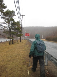
The prior day saw several inches of rain and the forecast for our hike wasn’t much better. Steady rain was predicted with temps down in the low to mid-40’s. Dennis is a very experienced New England hiker (having completed his Long Trail thru-hike last year, and finishing the New Hampshire 48 as well) and I’m just dumb, so we both pretended we weren’t concerned with the weather at all.
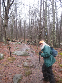
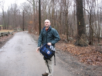
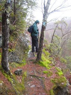
The one, the only… Cumulus
We got to know each other over these first miles, avoiding puddles (why, I don’t really know) and having a grand old time. Dennis is very familiar with these woods, which stretch south to Gay City and over to some neat areas of Glastonbury to the west. However, we were heading north on the Shenipsit and once we reached the trail where I’d left it as a bloody mess a month prior, off we went towards Case Mountain.
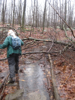
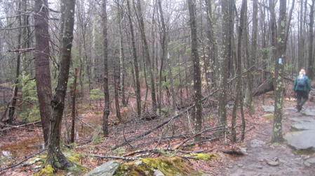
It was wet
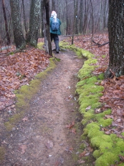
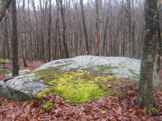
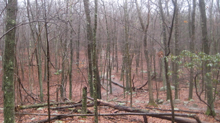
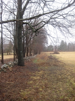
This was my first hike of the year with any color in the woods; the grayish-green of the lichen was popping in the still gray air. The faintest green of barely budding buds was becoming discernable. It was all very serene and oddly pretty in the light drizzle of the morning.
We crossed from Glastonbury to Manchester at some point, and passed junctions with a red trail and a yellow trail and then a yellow and gray trail. Dennis is familiar with all of these non-CFPA trails and has wandered along them many times. The terrain here is fairly flat, but the Shenipsit does ascend to (almost) the summits of the three “mountains” in Case Mountain Park.
The first is Birch Mountain (735’), then Lookout Mountain (744’ – this is the most popular one and the one which everyone refers to as Case Mountain) and finally Case Mountain (786’), surely the least visited summit in the park. Which is, y’know, ironic.
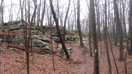
The hike through Case Mountain Park is very pretty. It follows the ridgeline and passes near several interesting geologic features; cliffs and erratics for the most part. (It also crosses/shares other trails frequently, so be aware.) Just north of Case Mountain proper, there is a nice section of bare rock ridge-walking with laurel thickets all around. It’s short and not spectacular, but it has a very “mountainous” feel to it somehow.
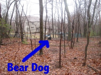
After the park, the trail continues north down to Birch Mountain Road. Just before the road, the trail passes between houses, one of which is home to several very loud dogs, fortunately behind a fence. It’s funny that one of the dogs in my picture looks strikingly like a black bear.
Safely past them, we reached the road and the small parking lot for our first little respite of the day. It also began raining a bit harder at this point, but neither of us tough guys bothered to even mention it.
The quick stop to put on hoods and pack covers gave me a chance to mention that the next little section of the Shenipsit is actually officially closed. After a 30 yard walk up the road, the trail turns right into the woods and down an embankment to cross the innocuous little Birch Mountain Brook. There used to be a bridge here, but it got washed away a little while ago and the CFPA suggests you walk around via roads. (I’m sure this is no longer true – Steve.)
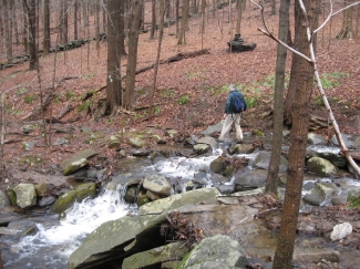
And officially, I agree with the CFPA – at least after heavy rain. Once Dennis and I reached the marshy area the brook cuts through, we sort of scoffed at the re-route and happily looked for a log or rock crossing. As you can see from the picture below, the little brook doesn’t look like much at all. So Dennis went first, put his hiking pole in the water for stability and…
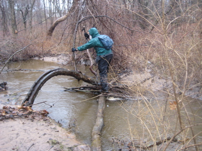
And…
Holy cow, where was the bottom?! This thing is four feet deep, which absolutely amazed the both of us. And it was actually moving pretty fast too. This was NOT something we wanted to fall into. We were almost speechless at the danger this silly little thing posed. Wow.
Once across, I stepped on what I thought was solid ground and nearly lost a shoe – but I did see the first skunk cabbage of the year!
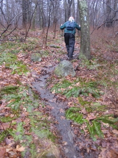
The next half mile is a tough slog. It was wet – very wet – and I imagine in the warmer months it’s just brutal with bugs. It’s not pretty at all, as it wends its way behind new houses along easements – easements created solely for run-off. So yes, you’re hiking along/in run-off routes the whole time. I did see a nice cat in one backyard, quietly eyeing us from afar.
The trail turns left and heads up to Amanda Drive right next to some nice houses (Get used to this along the central Shenipsit), across the road, and then straight up the hill on the other side.
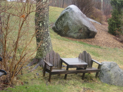
One homeowner has done a pretty cool gesture by sticking a bench out by the trail – as well as a child’s double Adirondack Chair. Thanks anonymous homeowner! Take a short rest here because the next bit of hiking is straight up the run-off easement. Right up through the little rivulet basically, up to a gas line.
Like I said, this isn’t the nicest section of hiking in the state. But it exists, which is awesome in its own right. It would have been easy to just cut the trail off at Birch Mountain Road and re-start it up at Freja Park in Bolton. Very easy. But someone fought for these right of ways and easements and has kept up with the trail maintenance and the like. I love that. I love that a kid can wander out of his backyard here and find blue rectangles on trees and wonder to himself why that is… And then can learn that if he follows those blue rectangles one way, he can go down to East Hampton and if he follows them the other way, he’ll find himself summiting Soapstone Mountain in Somers… And from there, he’ll learn about other mid and long distance trails.
Yes, I really love that. (And this sort of childhood wonderment is what keeps Dennis and I going as well, I suppose.)
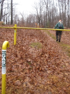
Continuing my theme, the Shenipsit doesn’t just follow the cleared gas line path, but rather parallels it in the woods for a while – another little touch I’ve come to really appreciate on our blue trails.
Well, that is until it crosses Carter Street. But that’s okay. The next mile or so of the trail is somewhat forgettable, though it does pass through a fairly healthy hemlock stand and crosses a few more creeks. The Walk Book mentions this being a great birding area as well, but I don’t think we saw any bird other than crows all day.
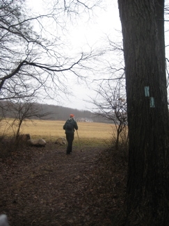
As we approached the long road walk section, a funny thing happened. The trail turned east for a bit and spit us out into a huge field. Hm, we weren’t expecting that! It was beautiful in its own quiet pastoral way. We sort of absorbed the scene individually and watched the low clouds roll over the drumlins in the distance.
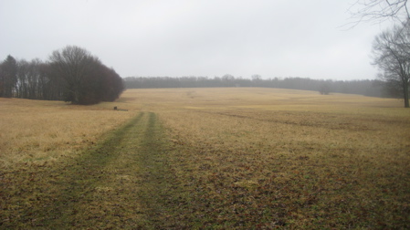
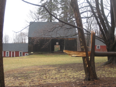
The trail turns north here and follows the treeline straight out to Route 85. Along the way, we passed some picturesque barns and tractors. If this had been a sunny day, this whole scene wouldn’t have worked as well I don’t think.
Of course, if it were a sunny day, I might have convinced Dennis to head the wrong way on 85 to hit the nearby Fish Family Farm for some ice cream, but as it was, with 30 mph gusts blowing 40 degree rain into our faces as we approached Bolton Notch, I didn’t mention it.
(The road walk as described here has since been made safer and better by following the Hop River multi-use trail, and is now officially part of the trail.)
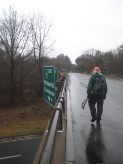
The road walk is just over a mile and it’s not too bad. It’s not blazed at all, but it is described in the Walk Book and does appear on the map. The mileage isn’t accounted for though, which is sort of weird. While crossing I-384, I remarked to Dennis that this highway crossing didn’t have the same romance as the AT crossing of the Mass Pike. He agreed.
His hat flew off and blew down the road, fortunately not over the railing onto the highway.
The walk up Route 6/44 was pretty brutal, with the wind and rain stinging our faces while drivers passed us taking pity. I was happy to see Dennis smiling wide (as was I) – or was that a gritty grimace? Hey man, it was just like hiking in New Hampshire in May! And we were heading right towards a notch! (Notches aren’t really named notches in CT, but are all over the place in New Hampshire). This was fun.
Sure it was ugly and no one likes road walks, but it wasn’t too long and was fairly safe. After passing a gas station (I contemplated buying a nice hot coffee, but thought Dennis would think me soft), we reached a commuter lot just off of 384 west and prepared to re-enter woods.
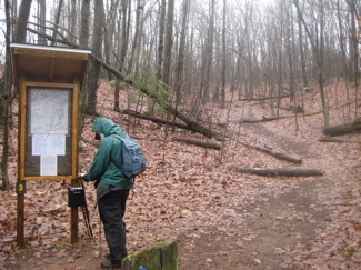
We stopped to read the rather comprehensive Freja Park sign. I’d never heard of Freja Park, but it has several trails and sort of bumps up against Bolton Notch State Park on the other side of the Rails to Trails path on the other side of Bolton Notch Pond.
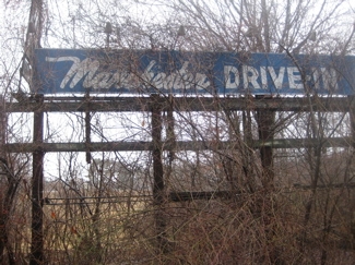
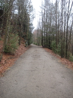
We hiked along the old road entrance to the very overgrown and very abandoned Manchester Drive-In. You’d think towns would force businesses to clean up their mess when they close, but apparently not.
Once the Shenipsit turns north away from the old drive-in, it skirts the edge of the pond which affords views east of the notch and Bolton Notch State Park. The Shenipsit doesn’t actually cross over into the state park, but I would suggest that those in charge make the bold move to take the trail down across the pond feeder, across the Hop River Rail Trail and into the state park, up the steep “mountain” and to Squaw Cave over there. Then just circle back down through the park to the Shenipsit, across that bridge right before the steep climb back up to the ridge.
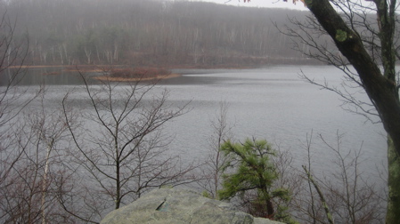
Bolton Notch Pond
Sure, it’ll look funny on a map, but it would be worth it, even with all that stupid graffiti up on the cliff faces.
Also, due west of this area over Box Mountain, is the Risley Pond Loop Trail, which is also part of the Shenipsit Area Trails.
Anyway, Dennis and I took a short break before that steep little climb up to the ridgeline and once up there, even he was surprised and impressed with how pretty it suddenly was. We could no longer hear the highway and with the rain and mist, it again felt like we were somewhere very far away from where we actually were.
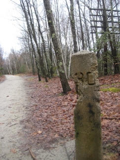
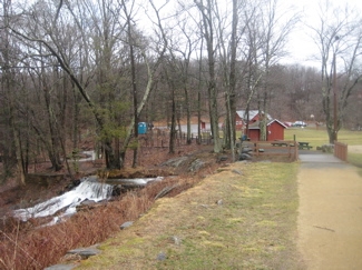
The walk along the ridge was excellent, followed by a very steep scramble back down to the valley and the rail trail. The nearly 2 miles along the Hop River Rail Trail was a long, flat, straight walk next to some very impressive rock faces. The old railroad electrical line posts still stand sentry all along the trail, as it approaches Valley Falls Park. This is a really cool stretch of rail trail.
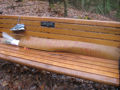
We finally crossed paths with other humans here, for the first time all day. We also passed a handsome bench dedicated to Ray Crothers, replete with flowers and old running shoes. Neither Dennis nor I had any idea who Ray Crothers was, but a quick Google Search educated me about the much beloved man.
We passed a few side trails and then left the rail trail to head east into Valley Falls Park. Down to the pond and then along a paved path, across a bridge and past a Braille Trail. And it’s not just a pithy 100 yard trail either – it’s actually pretty long with a ton of interpretive Braille signs about the history of the mill that was once here.
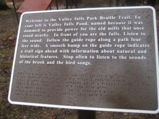
I had never seen a Braille trail before and I thought this was just awesome. Just a great idea and very well executed.
As we climbed another hill north of the park, I noticed a tiny blue patch of sky! It was supposed to rain steadily all day, and now the clouds were breaking up. Dennis insisted that this was because we were now in Vernon (his hometown), and everything is wonderful in Vernon.
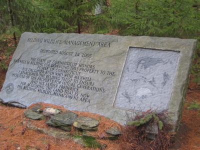
I don’t know about that, but I will say that the next mile or so of the Shenipsit through the Belding Wildlife Management Area is one my favorite flat miles of trail in the state. Whoa! That’s quite a statement there, Steve.
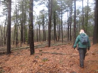
But really, it’s a lovely stretch for those of us who appreciate the subtle differences of evergreen forests. First, we passed through an area that once held a healthy stand of mature pitch pines – a rarity so far inland. Most have been chopped down because without the pitch pines natural way of propagation – fire – anymore, these mature stands just grow, die, and don’t come back. The forest managers are trying to combat that.
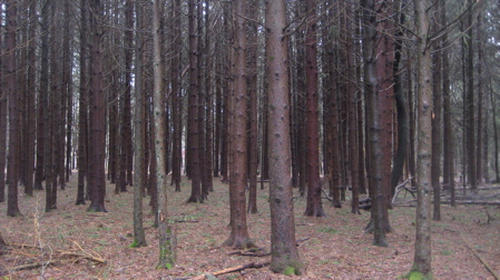
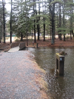
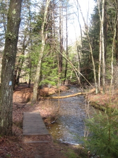
But don’t fret, once you cross Bolton Road and descend to cross a stream, the trail turns left and enters an incredible stand of mature pitch pines (mixed in with some red pines as well.) It’s beautiful – and just smells wonderful. It didn’t hurt that the sun was now shining a bit against the wet trees and ground. This folks… This is why we hike.
But the beauty wasn’t done yet; across an old dam and then a turn north to follow along the Tankerhoosen River for a while – a pristine fast flowing tiny river, twisting and turning through the pine and hemlock forest. I’m no fisherman, but if I was, this is where I’d fish. It just looked… so classic.
Continuing north out of the Belding Area, across Baker Road and… The whole thing turns to junk. But in a weird, interesting, almost kitschy way. For some reason (assuredly private land ownership), the trail veers over toward I-84.
“Okay, whatever,” you think, “so there’s a highway over there to my left.” Keep hiking north.
Before long, you’re almost on the dang shoulder! I never noticed, but the next time I drove this stretch of 84 East (just before exist 67), I looked into the woods and the blue blazes are easily seen at 70mph just a few feet into the woods! I wonder if I’ll ever see a hiker there for the rest of my life?
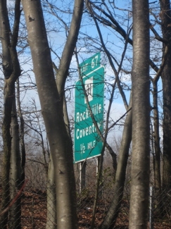
There is a chain link fence separating highway and hiker, but it’s just not a fun stretch. Dennis and I couldn’t hear each other at all. Hey, you know what? Highway exit signs are way bigger when they’re looming over your head than when you’re zooming by them in a car. This goes on for about 15 minutes, which is 14 minutes too long.
The trail finally turns east away from the highway and down and around a reservoir on its way out to Reservoir Road. Once up and over the guardrail onto the road – a really fun road to drive, by the way – you can go hike around Walker’s Reservoir for a while if you want.
We chose not to… And ambled up the road to the commuter lot and the end of our somewhat strange day.
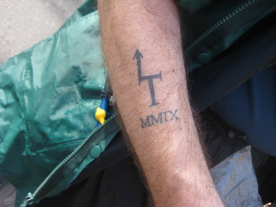
Did I mention Dennis thru-hiked the Long Trail last summer? Bad Ass. Oh, AND he got a tattoo.
You thought I was done? Nope… The last landmark we passed was the remains of what was the New England Sportsplex. Now, it’s an overgrown wasteland, which is a shame. It always looked like a cool place just a few years ago before it closed. A somewhat poignant ending to a somehow poignant day.
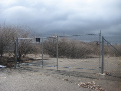
The abandoned SportsPlex
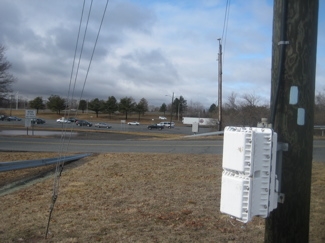
The end of our day at the Vernon commuter lot
Continue on to Section 4: Shhhhhhhenipsit
CFPA Trails Map
CTMQ’s Shenipsit Trail Intro
 Cumulus says
April 15, 2010 at 6:36 pmSo I’m both learned and bad-ass? Sounds about right. ;-) Anyway, thanks for having me along, and motivating me to finally explore the trails nearest my home. For your readers who don’t realize it: although I’m very familiar with the trails we started on, after we passed the “small hiker parking lot” it was almost all new trail for me, even though part of it passed less than a mile from my house.
 Brian Kosnoff says
April 15, 2010 at 7:59 pmHey Dennis, aka Cumulus. This sounds like an interesting hike. It’s actually the first I’ve heard of the Shenipsit Trail. It’s always nice to see more of the state. I know at some point this summer or fall my dad and I plan to hike a good portion of the Mattabesett and Metacomet trails. We want to do a 3 day, camp out overnight hike across CT and possibly into Mass on them. Hopefully we will get some better weather for, and I think we try to keep out of Gay City.
 Rose Marie Himes says
April 16, 2010 at 7:53 amThe description and photos made this a very interesting article. Of course, my son, Dennis Himes, is always good company. He also loves being on a trail so he made a knowledgeable companion.
 J says
May 16, 2012 at 2:42 amMinor thing: That’s actually the abandoned Bolton Drive-In, not Manchester.
 Steve says
January 18, 2013 at 4:30 pmJ – maybe. But look at the sign in the picture!
 Jamie says
June 28, 2023 at 10:15 amThat lovely Belding Wildlife Management Area stone sign has been broken in half, likely by a fallen tree. I am section hiking this trail from north to south and have done the northern section of this piece. It’s been rerouted in a couple places since you wrote this in 2010. I will have to keep an eye out for that crazy deep stream. The section between CT 85 and Camp Meeting Road is currently garbage. Not maintained and poorly blazed. I do agree that the section that runs along Tankerhoosen River is lovely. The rail trail section between Bolton Notch and Valley Falls is pretty good for birding. The rest, I don’t think so.
 Jamie says
June 29, 2023 at 6:51 pmFinished up this section today. Crazy deep stream was not to be seen so I assume they did in fact reroute it from there at some point. The section between Camp Meeting Road and Case Mountain Recreation Area is as bad as that other crap spot I mentioned yesterday. I have read that people sometimes thru-jog this thing? I couldn’t see what was in front of me and I was walking! They really need to do some work between Bolton Notch and Case Mountain. I have 19 miles more to go until the southern terminus and I hope this was the worst of it.